Clécy

zefreefly
User
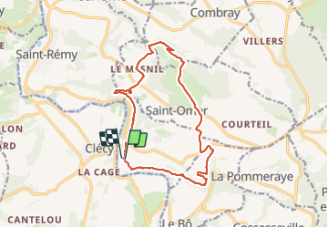

Length
14.8 km

Max alt
262 m

Uphill gradient
419 m
Km-Effort
20 km

Min alt
41 m

Downhill gradient
426 m
Boucle
Yes
Creation date :
2023-09-30 09:55:08.0
Updated on :
2023-09-30 15:12:19.324
3h51
Difficulty : Easy

FREE GPS app for hiking
 SityTrail
IGN / Geographical institutes
SityTrail Plus
The world is yours!
About
Trail Walking of 14.8 km to be discovered at Normandy, Calvados, Le Vey. This trail is proposed by zefreefly.
Description
Boucle autour de Clécy
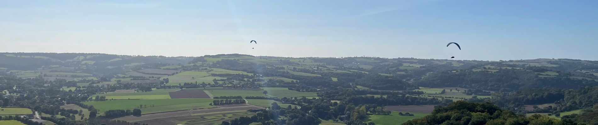
Photos


Positioning
Country:
France
Region :
Normandy
Department/Province :
Calvados
Municipality :
Le Vey
Location:
Unknown
Start:(Dec)
Start:(UTM)
685195 ; 5420917 (30U) N.
Comments